The first high-resolution digital model of the La Palma volcano is published

The Volcanological Institute of the Canary Islands (Involcan) has released the first high-resolution digital model of the La Palma volcano, saying that the eruption had "an enormous impact on the morphology and ecosystem of La Palma and this creation of a digital model, just a few months after it ended, will be useful for the reconstruction process of the area".
In the study entitled 'High-resolution Digital Surface Model of the 2021 eruption deposit of Cumbre Vieja volcano, La Palma, Spain', which has just been published in the magazine 'Scientific Data', researchers from the Instituto Nazionale di Geofisica e Volcanologia (INGV), in collaboration with researchers from Involcan, present the first high-resolution digital model of the surface and share some of the main results of the study of the eruption.
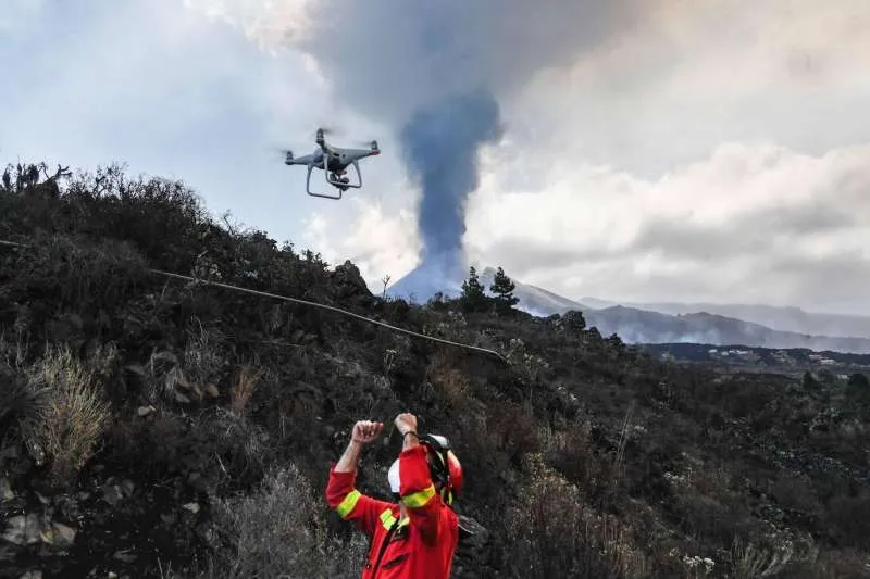
The data was obtained from aerial photos and measurements made with drones during the eruption, and at the end of it using 'Structure from Motion' techniques. The INGV team of researchers also specialized in filming in volcanic risk areas, intervened from the beginning of the eruption in the field of international scientific collaboration at the request and in coordination with Involcan.
Riccardo Civico, INGV researcher and lead author of the study, highlights that "more than 200 million cubic metres of deposits, mainly made up of lava, have caused profound morphological changes in the western part of the island, affecting both the natural environment and the in an area of tens of square kilometres, as evidenced by the digital model presented in this publication”.
Luca D'Auria, director of the Volcanic Surveillance Department at Involcan adds that "the lava produced by the eruption, which at some points is more than 60 metres thick, has destroyed more than 1,600 buildings, more than 200 hectares of banana plantations, the main economic resource of the island in addition to tourism, as well as strategic infrastructures such as roads, power lines, aqueducts, reaching the ocean and modifying the coastline.”
“This work provides us with an important contribution to define the framework of the eruption and constitutes a useful instrument for the planning of interventions to recover the urban area invaded by the products of volcanic activity”.
Piergiorgio Scarlato, coordinator of the activities of the INGV in collaboration with the Involcan in La Palma during the eruption, concludes that "drones continue to be decisive instruments for safely detecting areas affected by natural phenomena that cannot be reached by another way, especially during a volcanic eruption.”
“During the more than 800 kilometres of flights carried out by our drones, more than 12,000 high-resolution and geo-referenced aerial images were produced, which has allowed us to build a detailed map of the lava field and the new volcanic edifice already formed during the eruption. It made it possible to calculate the total volume and the emission rate of the volcanic materials ejected by the volcano between September and December 2021.
Share: