
Another earthquake detected in the Canary Islands, felt across two islands

The Spanish National Geographic Institute (IGN) have reported that they recorded a 3.8-magnitude earthquake near Frontera, on the island of El Hierro, last night (Thursday) at 8:34pm at a depth of 29 kilometres. It was felt in various places in El Hierro, including Sabinosa and Valverde, as well as in parts of La Palma, such as El Paso and Los Llanos de Aridane.
Despite being felt across two islands, the earthquake's intensity, measured at II-III, posed no threat to the population or infrastructure, according to the IGN.
Seismic Activity in the Canary Islands
This latest tremor follows a period of increased seismic activity between September 7th and 12th (as shown in the image below), during which the Canary Islands Seismic Network, operated by the Canary Islands Volcanology Institute (Involcan), detected 39 earthquakes between Tenerife and Gran Canaria. The most powerful of these had a magnitude of 3.1 on the Richter scale.
The seismic activity was concentrated around the Enmedio Volcano, an underwater mountain rising 470 metres above the seafloor, known for its seismic events recorded since the last century.
While these tremors do not currently present significant risks, the ongoing seismic activity serves as a reminder of the region's dynamic geological nature.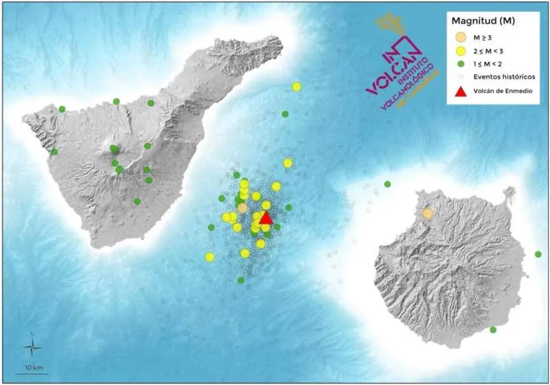
Share:


