A storm is set to sweep the Islands this week bringing intense rains and haze
- 13-12-2021
- National
- Canarian Weekly
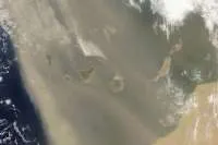
The State Meteorological Agency (Aemet) have warned that a storm is heading to the Canary Islands from the west, which will bring meteorological instability as it approaches La Palma first and will then sweep across the rest of the islands. Aemet is forecasting intense rains in the north of the islands and at altitude, more snow on Teide, and a calima type haze in the upper layers of the atmosphere, especially in the easternmost islands.
Today, Monday, will be a day of transition with cloudy intervals in the western islands (La Palma, La Gomera, El Hierro, and Tenerife) with clearings and sunny spells in the south during the day. In the eastern islands (Lanzarote, Fuerteventura, and Gran Canaria), clear skies are generally forecast, with some cloudy intervals in the north and northeast of Gran Canaria during the morning. This afternoon, high clouds will spread from west to east across the archipelago, with light to moderate winds.
Tomorrow, Tuesday, the changes begin with cloudy intervals in the northeast and east of the western islands with moderate rainfall, especially in the north of La Palma. In the eastern islands, slightly cloudy skies with intervals of high clouds and probable haze are expected. Temperatures will remain unchanged and the wind in the western islands will be moderate from a north direction. In the central ones, Tenerife and Gran Canaria, winds will be generally weak; and in the easternmost, strong gusts from the south.
Looking ahead to Wednesday, instability will increase with the arrival of moderate rainfall on the islands of greater relief, which are forecast to be strong, especially in the north and east of Tenerife. The haze and rain showers will remain in Lanzarote and Fuerteventura during the first half of the day.
The strongest part of the storm will reach Tenerife, Gran Canaria, Lanzarote, and Fuerteventura, with the most rain, lower temperatures, and high winds. However, they are forecast to ease off on Thursday afternoon and return to normal by next weekend for the time of year.
Other articles that may interest you...
Trending
Most Read Articles
Featured Videos
TributoFest: Michael Buble promo 14.02.2026
- 30-01-2026
TEAs 2025 Highlights
- 17-11-2025


