
Satellite cameras for predicting and monitoring earthquakes

History knows many examples of disastrous earthquakes that have claimed thousands of lives. While it is impossible to control our planet’s volcanic activity, modern technological advances allow predicting earthquakes with reasonable accuracy. And satellite camera tech plays a major part in that. Today, scientists rely on satellite cameras for predicting earthquakes not only to forecast potential disasters but also to mitigate their consequences and study volcanic activity.
But how are satellites used to study earthquakes? And, more importantly, why are these studies so important? Find the answers to those and a few other questions below.
How do satellite cameras for earthquake monitoring work?
When people hear about predicting disaster through space monitoring, many wonder — can satellites predict earthquakes? By themselves, satellites cannot predict anything. However, satellite cameras, designed specifically for Earth observation, capture images of our planet and send them back to the ground stations for analysis. As a result, scientists have access to regularly updated, high-resolution satellite camera images of our planet’s surface that allow us to study seismic changes in a given region.
By analysing how the land surface changes over time, scientists can offer reasonably accurate earthquake forecasts. Sure, analysis of satellite camera imagery still has some limitations. For example, it’s often challenging to come up with a short-time prediction or last-minute warning, as most forecasts can only offer general estimates about expected volcanic activity in a larger area.
Still, a more or less accurate earthquake prediction method that involves using satellite camera imagery relies on three major techniques — optical satellite camera imaging, synthetic aperture radar (SAR), and earthquake signature detection.
Optical satellite cameras
Optical imaging satellites use cameras that capture pictures in different light spectrums, starting from visible wavelengths to infrared. Scientists use these pictures to study any changes that result from seismic activity, such as fault lines, land deformation, or the consequences of earthquakes.
For earthquake prediction, the analysis of fault lines is the primary aspect to focus on because these lines indicate stress accumulation on ‘weak’ areas and, after a continuous analysis, can serve as earthquake precursors.
Synthetic Aperture Radar (SAR)
The primary benefit of Synthetic Aperture Radar (SAR) tech in satellite monitoring is that SAR cameras do not rely on optical sensors, which means they do not depend on lighting conditions.
SAR imagers emit microwave signals towards the Earth and analyse the reflected signals. Since this satellite camera tech relies on microwave signals rather than spectral wavelength, it can penetrate cloud covers and collect data on land activity 24/7, regardless of weather conditions.
This makes SAR cameras indispensable in an earthquake monitoring system. This satellite tech is a way more reliable method of analysing seismic activity. It can help pinpoint the location of an upcoming earthquake with up to a millimetre accuracy.
A sub-type of SAR satellite camera tech is the Interferometric Synthetic Aperture Radar (InSAR). The method implies using two SAR cameras to create interferograms, showing land changes as they happen per minute and allowing for a very accurate estimate of seismic activity. Any rapid changes over short time intervals are strong indicators of seismic shifts and, to date, one of the surest methods to provide early warnings of a potential earthquake.
Earthquake Signature Detection
Another relatively accurate method of using satellite cameras for predicting earthquakes relies on analysing an entire series of patterns. The major anomalies to keep an eye on include changes in Earth's magnetic fields, thermal anomalies, and emissions of gases from the Earth’s crust. Any rapid changes in these areas are seen as earthquake signatures.
Predictably, scientists rely on satellite cameras to obtain this information. All of the three methods combined serve as a reasonably accurate sign of an upcoming earthquake. Still, the major challenge is predicting the exact time and strength of the disaster.
Real-life examples: monitoring seismic areas
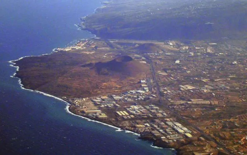
In seismically active regions, satellite camera observation tech clearly has its reasons. Japan, for example, has one of the most advanced prediction systems in the world, and a recent earthquake in Tenerife (or rather, a series of ten earthquakes in just 24 hours) is a perfect example of how satellite camera tech can improve life on Earth. Even now, the region is still experiencing high seismic activity.
So, is Tenerife at risk of earthquakes? According to satellite camera data, minor-scale quakes happen there all the time, but so far, there is no reason to suspect a major disaster. Still, without modern satellite camera tech, it would be highly challenging to keep track of alarming seismic activity. The use of satellite cameras for predicting earthquakes and monitoring their consequences is already a vital achievement in geoscience. This technology helps us understand seismic activities and warn the local population about upcoming disasters.
In seismically active regions like Japan and Tenerife, these space tech advancements could mean the difference between life and death. While predicting the exact time and strength of an earthquake is still challenging, there is hope that technology will keep evolving further, allowing for an even greater degree of accuracy in the future.
Share:


