Five earthquakes detected within half an hour this Friday morning in the Canary Islands
- 14-03-2025
- National
- INVOLCAN .
- Photo Credit: IGN
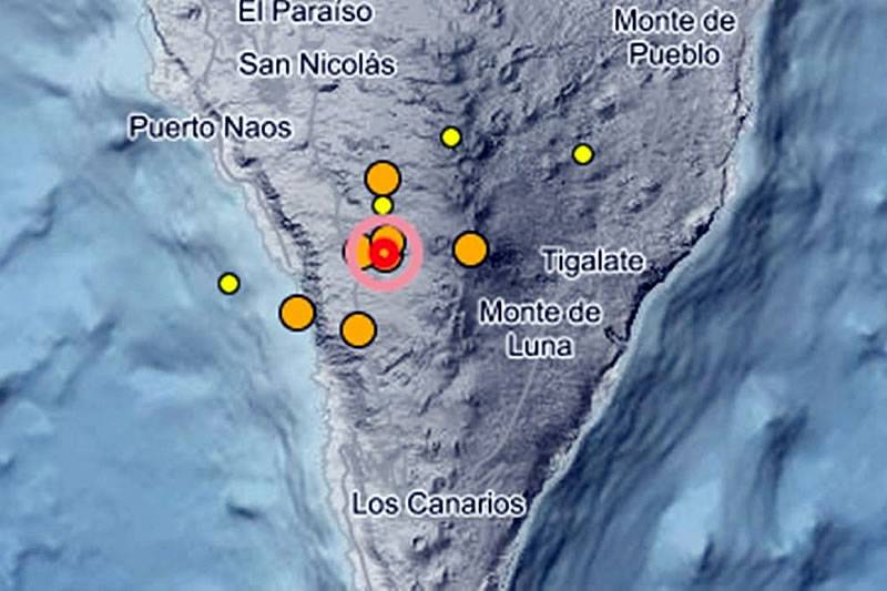
The National Geographic Institute (IGN) recorded a series of five earthquakes this morning, Friday 14th March, on the island of La Palma within a short time span of just 30 minutes, between 7:33am and 8:03am.
Four of the five earthquakes were detected in the northern area of Fuencaliente de La Palma. The first in this sequence, registering a magnitude of 2.3 on the Richter scale, took place at 7:35am at a depth of 10 kilometres. Just two minutes later, at 7:37am, another tremor of the same magnitude was recorded, this time at a depth of 12 kilometres.
The third earthquake in Fuencaliente occurred at 8:02am, again with a magnitude of 2.3 mbLg, but at a depth of 13 kilometres. The final and most intense tremor in this location followed shortly after, at 8:03, reaching a magnitude of 2.6 at a depth of 10 kilometres.
A fifth earthquake, of lesser intensity, was recorded southwest of Villa de Mazo. This tremor, which marked the beginning of the sequence at 7:33am, had a magnitude of 1.6 mbLg and originated at a depth of 11 kilometres.
This cluster of seismic activity has drawn attention from local authorities and experts as it is not far from the eruption site on the island, although no damage or injuries have been reported.
The IGN continues to monitor the situation closely as seismic activity in the Canary Islands remains an area of ongoing research and observation.
Other articles that may interest you...
Trending
Most Read Articles
Featured Videos
TributoFest: Michael Buble promo 14.02.2026
- 30-01-2026
TEAs 2025 Highlights
- 17-11-2025


