
Temperatures finally start to drop across the Canary Islands this Sunday
Temperatures are expected to drop across the Canary Islands today (Sunday 9th August), bringing some relief following the recent spell of intense heat, although parts of the archipelago will still have highs of 30°C or more.
According to the latest forecast from the State Meteorological Agency (AEMET), the most noticeable temperature decreases will be in inland areas on the higher and more mountainous islands, particularly Tenerife and Gran Canaria.
Conditions will generally remain clear or only slightly cloudy, but cloudy skies are expected across northern parts of Tenerife and Gran Canaria, and across northern and western areas of Lanzarote and Fuerteventura, although sunny spells will develop around midday.
The lingering haze will continue to affect mid-altitude and higher areas initially, but is forecast to gradually clear during the second half of the day.
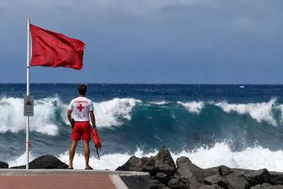
Moderate to rough seas are expected, together with a northeasterly swell of around one metre along northern coasts. Conditions will be considerably calmer along sheltered southern and southwestern coastlines.
Island-by-island forecasts for Sunday 9th August 2026:
Tenerife
Temperatures will fall, particularly in inland areas and across the eastern, southern and western midlands, where the decrease could be locally significant.
Coastal areas will also experience a slight drop in temperatures, although it will remain hot in parts of the south. Temperatures of between 30°C and 32°C are likely in lower areas of the Güímar Valley and southern Tenerife.
Trade winds could become strong on the southeast coast, in the extreme northwest and along the southern side of the metropolitan area during the afternoon, with occasional very strong gusts possible.
General temperature range: Minimum of 24°C to a maximum of 31°C.
Gran Canaria
Temperatures will drop in inland areas, particularly across the eastern, southern and western midlands, where the decrease could be substantial in some places.
Despite the cooler trend, temperatures between 30°C and 32°C are still forecast across large areas of the southern midlands and southeast, with isolated locations potentially reaching 34°C.
Overnight temperatures could also remain above 25°C in the areas most affected by the heat.
Strong trade winds and occasionally very strong gusts are expected on the southeast and northwest slopes, while southern coastal areas will see lighter breezes.
General temperature range: Minimum of 23°C to a maximum of 30°C.
Lanzarote
Cloudy conditions are forecast across northern and western Lanzarote, with clearer spells developing during the middle of the day. Elsewhere, skies will generally be only slightly cloudy.
Some light calima will remain at higher levels before clearing during the afternoon.
Minimum temperatures will see little change, while maximum temperatures will fall in eastern parts of the island.
The trade winds will continue and could become strong at times in southeastern areas, where locally very strong gusts cannot be ruled out.
General temperature range: Minimum of 23°C to a maximum of 31°C.
Fuerteventura
Northern and western Fuerteventura will start cloudy, although conditions should brighten during the middle of the day, particularly in the north. The rest of the island will generally remain slightly cloudy or clear.
Light calima at higher levels is expected to disappear from the afternoon onwards.
Maximum temperatures will fall in the southeast, although temperatures could still reach 30°C there.
The trade winds will be strong across inland areas of the southern half of the island, particularly during the afternoon and along the southern side of Jandía, where very strong gusts are possible.
General temperature range: Minimum of 22°C to a maximum of 30°C.
Share: